
Mapa topográfico Mont Singer
Mapa interactivo
Haga clic en el mapa para ver la altitud.
Acerca de este mapa
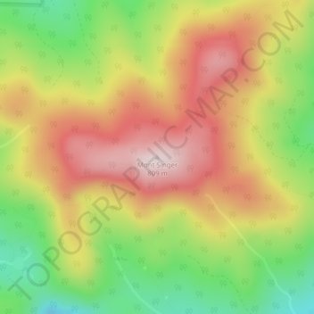
Nombre: Mapa topográfico Mont Singer, altitud, relieve.
Lugar: Mont Singer, Potton, Memphrémagog, Estrie, Quebec, Canada (45.13351 -72.45630 45.13361 -72.45620)
Altitud media: 603 m
Altitud mínima: 387 m
Altitud máxima: 800 m
Otros mapas topográficos
Haga clic en un mapa para ver su topografía, su altitud y su relieve.
Mont Éléphant
Canada > Quebec > Memphrémagog > Potton
Mont Éléphant, Potton, Memphrémagog, Estrie, Quebec, Canada
Altitud media: 389 m
Mont Hawk
Canada > Quebec > Memphrémagog > Potton
Mont Hawk, Potton, Memphrémagog, Estrie, Quebec, Canada
Altitud media: 345 m