
Mapa topográfico Hammond
Mapa interactivo
Haga clic en el mapa para ver la altitud.
Hammond
The city's elevation above sea level ranges from 577 feet (176 m) to 610 feet (186 m). The city sits within the boundaries of the former Lake Chicago, and much of its land area consists of former dune and swale terrain that was subsequently leveled. Most of the city is on sandy soil with a layer of black topsoil that varies from non-existent to several feet (a meter or more) thick. Much of the exposed sand was removed for purposes such as industrial use to make concrete and glass. According to the 2010 census, Hammond has a total area of 24.886 square miles (64.45 km2), of which 22.78 square miles (59.00 km2) (or 91.54%) is land and 2.106 square miles (5.45 km2) (or 8.46%) is water.
Acerca de este mapa
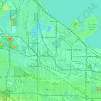
Nombre: Mapa topográfico Hammond, altitud, relieve.
Lugar: Hammond, Lake County, Indiana, United States (41.56637 -87.52539 41.71010 -87.43236)
Altitud media: 180 m
Altitud mínima: 170 m
Altitud máxima: 227 m