
Mapa topográfico Bulle
Mapa interactivo
Haga clic en el mapa para ver la altitud.
Acerca de este mapa
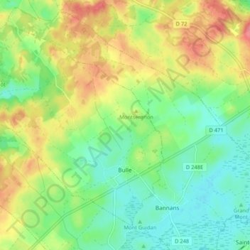
Nombre: Mapa topográfico Bulle, altitud, relieve.
Altitud media: 840 m
Altitud mínima: 808 m
Altitud máxima: 886 m
The municipality is the capital of the Gruyère district. It is located on a hill at an elevation of 770 meters (2,530 ft) above the left side of the Trême river.