
Mapa topográfico Bally
Mapa interactivo
Haga clic en el mapa para ver la altitud.
Acerca de este mapa
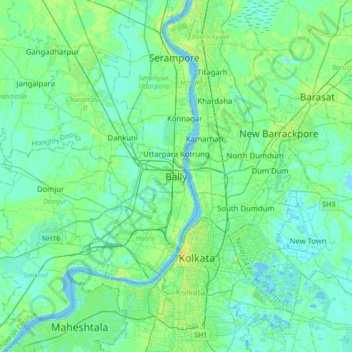
Nombre: Mapa topográfico Bally, altitud, relieve.
Altitud media: 6 m
Altitud mínima: -3 m
Altitud máxima: 23 m
Bally is located at 22°39′N 88°20′E / 22.65°N 88.34°E / 22.65; 88.34 and also the northern-most part of Howrah city. It has an average elevation of 15 metres (49 feet). Bally is separated from Uttarpara, Hooghly by Bally Canal (Bally Khal) at its north. A Bridge was constructed over Bally Canal in 1846 to join the two localities.