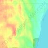
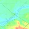
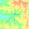
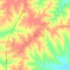
Mapa topográfico Marquette County
Haga clic en el mapa para ver la altitud.
Marquette County
Marquette County lies in central Wisconsin’s glaciated lowland-and-moraine country, where a generally subdued landscape is broken by sandy outwash plains, wet basins, lake margins, and low ridges left by Ice Age ice and meltwater. Elevations are modest but varied, from the broad, lower wetlands and waterways around the Fox River, Mecan River, White River, Buffalo Lake, and Lake Puckaway to higher, rolling uplands toward the west and northwest, including moraine-like ridges and isolated knobs that rise above the surrounding farmland and marshy flats. Much of the county has a gently undulating physical character, with shallow relief, drainage swales, small lakes, and peat- or marsh-lined depressions, while the western side becomes more irregular where the terrain grades toward higher sandy and rocky uplands near Adams County and the Wisconsin River country. Overall, Marquette County’s topography is defined less by steep slopes than by subtle glacial contrasts: open agricultural plains, low wooded rises, stream valleys, lake basins, and scattered high points that give the landscape a softly rolling, water-rich, and distinctly central-Wisconsin character.
Acerca de este mapa

Nombre: Mapa topográfico Marquette County, altitud, relieve.
Lugar: Marquette County, Wisconsin, United States (43.64258 -89.59963 43.98291 -89.16793)
Altitud media: 259 m
Altitud mínima: 231 m
Altitud máxima: 393 m
Otros mapas topográficos
Haga clic en un mapa para ver su topografía, su altitud y su relieve.
Danbury
United States > Wisconsin > Burnett County
Danbury is located at 46.006N. The longitude is -92.371W. It is in the Central Standard Time Zone. The elevation is 938 feet (286 m) above sea level.
Altitud media: 287 m


Rock Island
United States > Wisconsin > Door County
Rock Island is a mostly wooded island off the tip of Wisconsin's Door Peninsula at the mouth of Green Bay, in Door County, Wisconsin. The 974.87-acre (394.5 ha) island is approximately 1.6 miles (2.6 km) long and 1.1 miles (1.8 km) wide. It rises to 65 meters above Lake Michigan, making it the highest in…
Altitud media: 188 m

Mississippi River
United States > Wisconsin > Grant County > Dubuque
The uppermost lock and dam on the Upper Mississippi River is the Upper St. Anthony Falls Lock and Dam in Minneapolis. Above the dam, the river's elevation is 799 feet (244 m). Below the dam, the river's elevation is 750 feet (230 m). This 49-foot (15 m) drop is the largest of all the Mississippi River locks…
Altitud media: 203 m

Glacial Valley Park
United States > Wisconsin > Dane County > Village of Cross Plains
Altitud media: 287 m



Depere Lock and Dam
United States > Wisconsin > Brown County > De Pere > West De Pere
Altitud media: 186 m