
Mapa topográfico Mellery
Mapa interactivo
Haga clic en el mapa para ver la altitud.
Acerca de este mapa
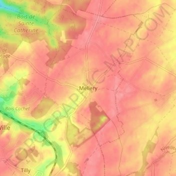
Nombre: Mapa topográfico Mellery, altitud, relieve.
Altitud media: 143 m
Altitud mínima: 89 m
Altitud máxima: 161 m
Otros mapas topográficos
Haga clic en un mapa para ver su topografía, su altitud y su relieve.
Marbais
Belgique > Brabant wallon > Nivelles > Villers-la-Ville
Marbais, Villers-la-Ville, Nivelles, Brabant wallon, Wallonie, Belgique
Altitud media: 147 m
Tilly
Belgique > Brabant wallon > Nivelles > Villers-la-Ville
Tilly, Villers-la-Ville, Nivelles, Brabant wallon, Wallonie, 1495, Belgique
Altitud media: 141 m
Sart-Dames-Avelines
Belgique > Brabant wallon > Nivelles > Villers-la-Ville
Sart-Dames-Avelines, Villers-la-Ville, Nivelles, Brabant wallon, Wallonie, Belgique
Altitud media: 146 m