
Mapa topográfico Strathcona Science Provincial Park
Mapa interactivo
Haga clic en el mapa para ver la altitud.
Acerca de este mapa
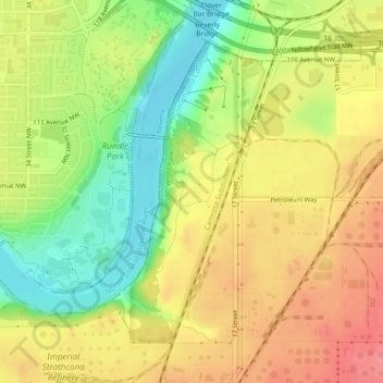
Nombre: Mapa topográfico Strathcona Science Provincial Park, altitud, relieve.
Altitud media: 653 m
Altitud mínima: 608 m
Altitud máxima: 691 m
The park is situated in the North Saskatchewan River valley, on both banks of the river, at an elevation of 625 m (2,051 ft) and has a surface of 2.9 km2 (1.1 sq mi). It was established on December 12, 1979 and is maintained by Alberta Tourism, Parks and Recreation.
Otros mapas topográficos
Haga clic en un mapa para ver su topografía, su altitud y su relieve.
Sherwood Park
Canada > Alberta > Strathcona County > Sherwood Park
Sherwood Park, Strathcona County, Alberta, Canada
Altitud media: 691 m