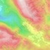
Mapa topográfico Magione
Haga clic en el mapa para ver la altitud.
Acerca de este mapa

Nombre: Mapa topográfico Magione, altitud, relieve.
Lugar: Magione, Perugia, Umbria, 06063, Italy (43.05175 12.08122 43.22676 12.30116)
Altitud media: 321 m
Altitud mínima: 207 m
Altitud máxima: 762 m
Otros mapas topográficos
Haga clic en un mapa para ver su topografía, su altitud y su relieve.


Gaglietole
Italy > Umbria > Perugia > Collazzone
Gaglietole is a frazione of the comune of Collazzone in the Province of Perugia, Umbria, central Italy. It stands at an elevation of 326 metres above sea level. At the time of the Istat census of 2001 it had 76 inhabitants.
Altitud media: 305 m

Castelleone
Italy > Umbria > Perugia > Deruta
Castelleone is a frazione of the comune of Deruta in the Province of Perugia, Umbria, central Italy. It stands at an elevation of 398 metres above sea level. At the time of the Istat census of 2001 it had 91 inhabitants.
Altitud media: 346 m


Vaiano
Italy > Umbria > Perugia > Castiglione del Lago
Vaiano is a frazione of the comune of Castiglione del Lago in the Province of Perugia, Umbria, central Italy. It stands at an elevation of 371 metres above sea level. At the time of the Istat census of 2001 it had 234 inhabitants.
Altitud media: 306 m


San Leo Bastia
Italy > Umbria > Perugia > Città di Castello
San Leo Bastia is a frazione of the comune of Città di Castello in the Province of Perugia, Umbria, central Italy. It stands at an elevation of 320 metres above sea level. At the time of the Istat census of 2001 it had 213 inhabitants.
Altitud media: 404 m


Ponticelli
Ponticelli is a frazione of the comune of Città della Pieve in the Province of Perugia, Umbria, central Italy. It stands at an elevation of 249 metres above sea level. At the time of the Istat census of 2001 it had 610 inhabitants.
Altitud media: 275 m


Pettino
Italy > Umbria > Perugia > Campello sul Clitunno
It stands at an elevation of 1074 metres above sea level. At the time of the Istat census of 2001, it had only 74 inhabitants.
Altitud media: 1.141 m


Casalalta
Italy > Umbria > Perugia > Collazzone
Casalalta is a frazione of the comune of Collazzone in the Province of Perugia, Umbria, central Italy. It stands at an elevation of 325 metres above sea level. At the time of the Istat census of 2001 it had 60 inhabitants.
Altitud media: 273 m