
Haz una donación
Equípate para tu próxima aventura:
Como asociado de Amazon, este sitio gana comisiones por las compras que califican, sin ningún costo adicional para usted.
Mapa topográfico Brazos Bend State Park
Haga clic en el mapa para ver la altitud.
Haz una donación
Equípate para tu próxima aventura:
Como asociado de Amazon, este sitio gana comisiones por las compras que califican, sin ningún costo adicional para usted.
Brazos Bend State Park
Brazos Bend State Park occupies land bordering the Brazos River and includes within its boundaries low-lying areas left over from the River's previous meanderings. Pre-Columbian inhabitants included a series of Native American groups, most notably the Karankawa. The land passed through a variety of landowners' hands, resulting in some of the existing structures on the park grounds, including a brick cistern. The park's current nature center is built into a structure previously utilized as a hunting cabin. Over the years, improvements were made to the various water bodies in the park for both recreational and flood management purposes. A low-elevation levied walkway surrounds the perimeter of some of the larger water bodies (Elm Lake, 40 Acre Lake, etc.). While significant modifications were made to the land within the park in the past, the current management strategy is to allow, in balance with the recreational elements of the park's mission, the maintenance of a natural landscape. In 1984 the park was officially opened to the public, its lands having been donated to the state several years previously. In 2009, the park celebrated its 25th anniversary with a variety of special events and recognitions. Today the park is run by the Texas Parks and Wildlife Department, with the assistance of an active non-profit volunteer organization.
Haz una donación
Equípate para tu próxima aventura:
Como asociado de Amazon, este sitio gana comisiones por las compras que califican, sin ningún costo adicional para usted.
Acerca de este mapa
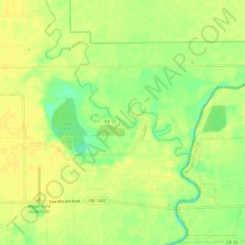
Nombre: Mapa topográfico Brazos Bend State Park, altitud, relieve.
Altitud media: 17 m
Altitud mínima: 4 m
Altitud máxima: 24 m
Haz una donación
Equípate para tu próxima aventura:
Como asociado de Amazon, este sitio gana comisiones por las compras que califican, sin ningún costo adicional para usted.