
Mapa topográfico Sha Tau Kok
Mapa interactivo
Haga clic en el mapa para ver la altitud.
Acerca de este mapa
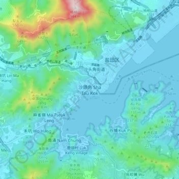
Nombre: Mapa topográfico Sha Tau Kok, altitud, relieve.
Altitud media: 138 m
Altitud mínima: -5 m
Altitud máxima: 922 m
Otros mapas topográficos
Haga clic en un mapa para ver su topografía, su altitud y su relieve.
Kat O Fisherman Village
China > Hong Kong > North District
Kat O Fisherman Village, North District, New Territories, Hong Kong, China
Altitud media: 3 m
So Kwun Po Village
China > Hong Kong > North District
So Kwun Po Village, North District, New Territories, Hong Kong, 518005, China
Altitud media: 27 m