Geolocalizar

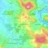
Mapa topográfico Haidhäuser

Haga clic en el mapa para ver la altitud.

Acerca de este mapa

Nombre: Mapa topográfico Haidhäuser, altitud, relieve.

Lugar: Haidhäuser, Cham, Landkreis Cham, Bayern, Deutschland (49.19930 12.63381 49.20463 12.64208)

Altitud media: 381 m

Altitud mínima: 364 m

Altitud máxima: 434 m

Otros mapas topográficos

Haga clic en un mapa para ver su topografía, su altitud y su relieve.
Gutmaning

Deutschland > Bayern > Landkreis Cham > Cham

Altitud media: 412 m

Chammünster

Deutschland > Bayern > Landkreis Cham > Cham

Altitud media: 399 m

Selling

Deutschland > Bayern > Landkreis Cham > Cham > Kothmaißling

Altitud media: 399 m

Haidhäuser

Deutschland > Bayern > Landkreis Cham > Cham

Altitud media: 383 m

Vilzing

Deutschland > Bayern > Landkreis Cham > Cham

Altitud media: 422 m

Haderstadl

Deutschland > Bayern > Landkreis Cham > Cham

Altitud media: 439 m

Equípate para tu próxima aventura:

🪵Hornillos de camping - Cocina portátil para exterior
👟Sandalias de Trekking Mujer - Protección y frescura para el verano
👟Sandalias de Trekking Hombre - Calzado ventilado para rutas con cruce de ríos
📖Manuales de supervivencia - Conocimientos esenciales
🧖Ponchos de Lluvia - Protección rápida que cubre también la mochila

Como asociado de Amazon, este sitio gana comisiones por las compras que califican, sin ningún costo adicional para usted.