
Mapa topográfico East Clifford
Mapa interactivo
Haga clic en el mapa para ver la altitud.
Acerca de este mapa
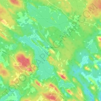
Nombre: Mapa topográfico East Clifford, altitud, relieve.
Altitud media: 97 m
Altitud mínima: 74 m
Altitud máxima: 132 m
Otros mapas topográficos
Haga clic en un mapa para ver su topografía, su altitud y su relieve.
Hirtle Lake
Canada > Nova Scotia > Lunenburg County > East Clifford
Hirtle Lake, East Clifford, Municipality of the District of Lunenburg, Lunenburg County, Nova Scotia, Canada
Altitud media: 93 m