
Mapa topográfico Olathe
Mapa interactivo
Haga clic en el mapa para ver la altitud.
Acerca de este mapa
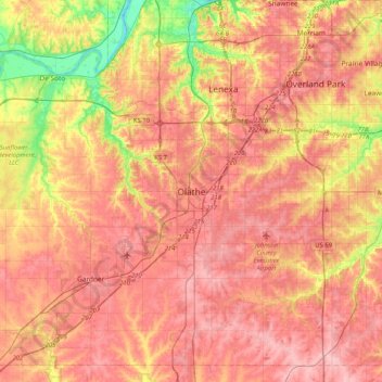
Nombre: Mapa topográfico Olathe, altitud, relieve.
Lugar: Olathe, Johnson County, Kansas, 6601, United States (38.72389 -94.97887 39.04389 -94.65887)
Altitud media: 302 m
Altitud mínima: 226 m
Altitud máxima: 347 m
Otros mapas topográficos
Haga clic en un mapa para ver su topografía, su altitud y su relieve.
Prairie Highlands
United States > Kansas > Johnson County > Olathe
Prairie Highlands, Olathe, Johnson County, Kansas, 66031, United States
Altitud media: 314 m