
Haz una donación
Equípate para tu próxima aventura:
Como asociado de Amazon, este sitio gana comisiones por las compras que califican, sin ningún costo adicional para usted.
Mapa topográfico Berwyn
Haga clic en el mapa para ver la altitud.
Haz una donación
Equípate para tu próxima aventura:
Como asociado de Amazon, este sitio gana comisiones por las compras que califican, sin ningún costo adicional para usted.
Berwyn
According to the 2021 census gazetteer files, Berwyn has a total area of 3.90 square miles (10.10 km2), all land. Bordering cities include Oak Park to the north, Cicero to the east, Stickney to the south, Lyons, Riverside, North Riverside, and Forest Park to the west. Geologically, Berwyn is predominately composed of Glacial Lake Bottom from the Wisconsin Glacial Episode, the most recent glacial period. A beach ridge of sand and gravel, made during one of the stages of Lake Chicago, is also present in the city. This is most easily identified as Riverside Drive. The elevation change due to the ridge is clearly seen on the 2800 block of Maple Ave. Prior to the settlement of Berwyn, the land was grassy marshland. The body of water that connected the South Branch of the Chicago River to the Des Plaines River was a shallow waterway or a muddy slough (depending on the season) known as Mud Lake. Mud Lake extended nearly to the southern border of today's Berwyn, and the southern end of Berwyn flooded regularly during heavy rains in its early years.
Haz una donación
Equípate para tu próxima aventura:
Como asociado de Amazon, este sitio gana comisiones por las compras que califican, sin ningún costo adicional para usted.
Acerca de este mapa
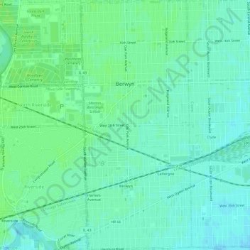
Nombre: Mapa topográfico Berwyn, altitud, relieve.
Lugar: Berwyn, Cook County, Illinois, United States (41.82115 -87.80422 41.86540 -87.77778)
Altitud media: 188 m
Altitud mínima: 183 m
Altitud máxima: 193 m
Haz una donación
Equípate para tu próxima aventura:
Como asociado de Amazon, este sitio gana comisiones por las compras que califican, sin ningún costo adicional para usted.
Otros mapas topográficos
Haga clic en un mapa para ver su topografía, su altitud y su relieve.
Haz una donación
Equípate para tu próxima aventura:
Como asociado de Amazon, este sitio gana comisiones por las compras que califican, sin ningún costo adicional para usted.
Haz una donación
Equípate para tu próxima aventura:
Como asociado de Amazon, este sitio gana comisiones por las compras que califican, sin ningún costo adicional para usted.
Haz una donación
Equípate para tu próxima aventura:
Como asociado de Amazon, este sitio gana comisiones por las compras que califican, sin ningún costo adicional para usted.
Haz una donación
Equípate para tu próxima aventura:
Como asociado de Amazon, este sitio gana comisiones por las compras que califican, sin ningún costo adicional para usted.
Haz una donación
Equípate para tu próxima aventura:
Como asociado de Amazon, este sitio gana comisiones por las compras que califican, sin ningún costo adicional para usted.
Chicago, North Shore & Milwaukee
United States > Illinois > Cook County > Northbrook > Williamsburg Square
Altitud media: 198 m
Haz una donación
Equípate para tu próxima aventura:
Como asociado de Amazon, este sitio gana comisiones por las compras que califican, sin ningún costo adicional para usted.
Elmwood Park
United States > Illinois > Cook County > Elmwood Park > Elmwood Park
Altitud media: 194 m
Haz una donación
Equípate para tu próxima aventura:
Como asociado de Amazon, este sitio gana comisiones por las compras que califican, sin ningún costo adicional para usted.