
Mapa topográfico Abbey St. Bathans
Mapa interactivo
Haga clic en el mapa para ver la altitud.
Abbey St. Bathans
Abbey St Bathans (Scottish Gaelic: Abaid Bhaoithin) is a parish in the Lammermuir district of Berwickshire, in the eastern part of the Scottish Borders. Unique in its topography, it is situated in a long winding steep wooded valley that follows the Whiteadder Water. The parish had a population of 106 at the 2011 Census.
Acerca de este mapa
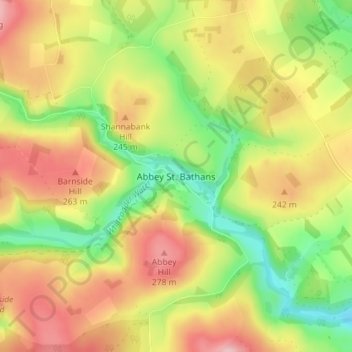
Nombre: Mapa topográfico Abbey St. Bathans, altitud, relieve.
Altitud media: 212 m
Altitud mínima: 128 m
Altitud máxima: 296 m