
Mapa topográfico Millarville
Mapa interactivo
Haga clic en el mapa para ver la altitud.
Acerca de este mapa
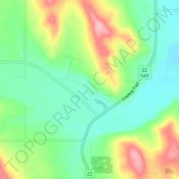
Nombre: Mapa topográfico Millarville, altitud, relieve.
Lugar: Millarville, Foothills County, Alberta, T0L 1K0, Canada (50.73815 -114.34538 50.77815 -114.30538)
Altitud media: 1.220 m
Altitud mínima: 1.168 m
Altitud máxima: 1.323 m
Otros mapas topográficos
Haga clic en un mapa para ver su topografía, su altitud y su relieve.
Red Deer Lake
Canada > Alberta > Foothills County
Red Deer Lake, Foothills County, Alberta, Canada
Altitud media: 1.140 m
Cayley
Canada > Alberta > Foothills County
Cayley, Foothills County, Alberta, Canada
Altitud media: 1.070 m