Mapa topográfico Barra
Haga clic en el mapa para ver la altitud.
Barra
The highest elevation on the island is Heaval, near the top of which is a prominent white marble statue of the Madonna and Child, called "Our Lady of the Sea", which was erected during the Marian year of 1954. The predominant faith on the island is Catholicism and the Catholic church dedicated to Our Lady of the Sea is apparent to those arriving at Castlebay.
Acerca de este mapa
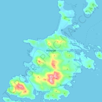
Nombre: Mapa topográfico Barra, altitud, relieve.
Lugar: Barra, Borve, Western Isles, Scotland, United Kingdom (56.94325 -7.56278 57.05895 -7.36846)
Altitud media: 27 m
Altitud mínima: -1 m
Altitud máxima: 373 m
Otros mapas topográficos
Haga clic en un mapa para ver su topografía, su altitud y su relieve.