
Mapa topográfico Vitosha
Mapa interactivo
Haga clic en el mapa para ver la altitud.
Acerca de este mapa
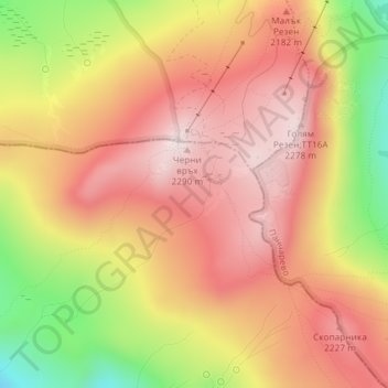
Nombre: Mapa topográfico Vitosha, altitud, relieve.
Lugar: Vitosha, Pernik, Bulgaria (42.55995 23.27995 42.56005 23.28005)
Altitud media: 2.105 m
Altitud mínima: 1.820 m
Altitud máxima: 2.282 m
Due to a great variability in elevation, a rich diversity of climates, flora and fauna can be found within the park. Research has revealed that on the comparatively small area of the mountain there are 1,500 species of higher plants, 500 species of fungi, 500 species of algae, 326 species of mosses, and 200 species of lichens. Among the, 31 species are Balkan endemics and 52 species are included in the IUCN Red List of endangered species.
Otros mapas topográficos
Haga clic en un mapa para ver su topografía, su altitud y su relieve.