
Haz una donación
Equípate para tu próxima aventura:
Como asociado de Amazon, este sitio gana comisiones por las compras que califican, sin ningún costo adicional para usted.
Mapa topográfico Crescent City
Haga clic en el mapa para ver la altitud.
Haz una donación
Equípate para tu próxima aventura:
Como asociado de Amazon, este sitio gana comisiones por las compras que califican, sin ningún costo adicional para usted.
Crescent City
The topography of the sea floor surrounding Crescent City has the effect of focusing tsunamis. According to researchers at Humboldt State University and the University of Southern California, the city experienced tsunami conditions 31 times between the years 1933 and 2008. Although many of these incidents were barely perceptible, eleven events included wave measurements exceeding one meter, four events caused damage, and one event in particular is commonly cited as "the largest and most destructive recorded tsunami to strike the United States Pacific Coast."
Haz una donación
Equípate para tu próxima aventura:
Como asociado de Amazon, este sitio gana comisiones por las compras que califican, sin ningún costo adicional para usted.
Acerca de este mapa
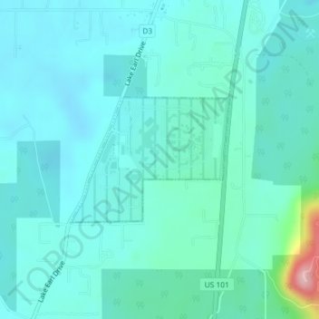
Nombre: Mapa topográfico Crescent City, altitud, relieve.
Lugar: Crescent City, Del Norte County, California, United States (41.84782 -124.16017 41.85846 -124.14190)
Altitud media: 31 m
Altitud mínima: 2 m
Altitud máxima: 203 m
Haz una donación
Equípate para tu próxima aventura:
Como asociado de Amazon, este sitio gana comisiones por las compras que califican, sin ningún costo adicional para usted.
Otros mapas topográficos
Haga clic en un mapa para ver su topografía, su altitud y su relieve.
Smith River National Recreation Area
United States > California > Del Norte County
Altitud media: 720 m
Haz una donación
Equípate para tu próxima aventura:
Como asociado de Amazon, este sitio gana comisiones por las compras que califican, sin ningún costo adicional para usted.
Klamath Glen
United States > California > Del Norte County
Klamath Glen is an unincorporated community in Del Norte County, California. It is located on the Klamath River 5 miles (8 km) from its mouth, at an elevation of 46 feet (14 m).
Altitud media: 97 m