
Mapa topográfico Wetterhorn
Mapa interactivo
Haga clic en el mapa para ver la altitud.
Acerca de este mapa
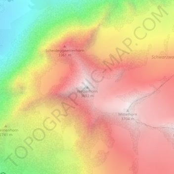
Nombre: Mapa topográfico Wetterhorn, altitud, relieve.
Altitud media: 2.864 m
Altitud mínima: 1.742 m
Altitud máxima: 3.687 m
Otros mapas topográficos
Haga clic en un mapa para ver su topografía, su altitud y su relieve.
Berner Alpen
Switzerland > Bern > Grindelwald
Berner Alpen, Grindelwald, Verwaltungskreis Interlaken-Oberhasli, Verwaltungsregion Oberland, Bern, Switzerland
Altitud media: 3.306 m