
Mapa topográfico Digos
Haga clic en el mapa para ver la altitud.
Digos
The land topography of Digos City ranges from hilly to mountainous in the north-northeast portion and flat and slightly rolling at the coastal barangays, while the urban area and the surrounding barangays in the south portion are generally flat. Generally, climate in Digos falls under the fourth type while wind direction is prevalent from northeast to southwest. On the other hand, rainfall is evenly distributed throughout the year wherein during the period from 1995 to 2000, there was no observed extreme dry or wet season.
Acerca de este mapa
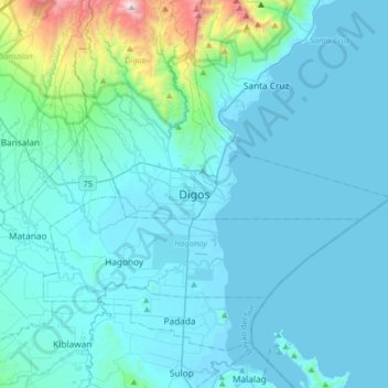
Nombre: Mapa topográfico Digos, altitud, relieve.
Lugar: Digos, Davao del Sur, Davao Region, 8002, Philippines (6.58438 125.19563 6.90438 125.51563)
Altitud media: 152 m
Altitud mínima: -4 m
Altitud máxima: 1.652 m