
Mapa topográfico The Borough District of Drogheda
Mapa interactivo
Haga clic en el mapa para ver la altitud.
Acerca de este mapa
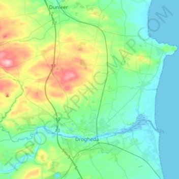
Nombre: Mapa topográfico The Borough District of Drogheda, altitud, relieve.
Altitud media: 50 m
Altitud mínima: -1 m
Altitud máxima: 209 m
Otros mapas topográficos
Haga clic en un mapa para ver su topografía, su altitud y su relieve.
Plaster
Plaster, Ballymascanlan ED, The Municipal District of Dundalk, County Louth, Leinster, Irlanda
Altitud media: 55 m