
Haz una donación
Equípate para tu próxima aventura:
Como asociado de Amazon, este sitio gana comisiones por las compras que califican, sin ningún costo adicional para usted.
Mapa topográfico Komatke
Haga clic en el mapa para ver la altitud.
Haz una donación
Equípate para tu próxima aventura:
Como asociado de Amazon, este sitio gana comisiones por las compras que califican, sin ningún costo adicional para usted.
Komatke
Saint John the Baptist Parish Laveen, the Saint Johns Mission, is in Komatke. The name is taken from the mission school founded by the Franciscans in 1894. It has an estimated elevation of 1,030 feet (310 m) above sea level.
Haz una donación
Equípate para tu próxima aventura:
Como asociado de Amazon, este sitio gana comisiones por las compras que califican, sin ningún costo adicional para usted.
Acerca de este mapa
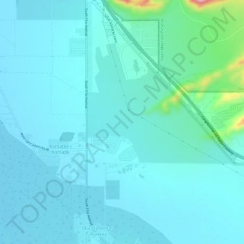
Nombre: Mapa topográfico Komatke, altitud, relieve.
Lugar: Komatke, Maricopa County, Arizona, United States (33.27412 -112.17730 33.32354 -112.15071)
Altitud media: 335 m
Altitud mínima: 309 m
Altitud máxima: 528 m
Haz una donación
Equípate para tu próxima aventura:
Como asociado de Amazon, este sitio gana comisiones por las compras que califican, sin ningún costo adicional para usted.