

Mapa topográfico Sansha
Haga clic en el mapa para ver la altitud.
Sansha
The land around Sansha is mostly hilly, but to the south it is flat. To the southeast, the sea is closest to Sansha. The highest point in the vicinity has an elevation of 516 meters and is 2.3 km northwest of Sansha. Sansha is the largest town in the area. In the region around Sansha, islands are unusually common.
Acerca de este mapa
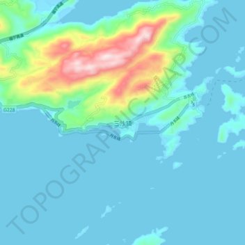
Nombre: Mapa topográfico Sansha, altitud, relieve.
Lugar: Sansha, Xiapu County, Ningde City, Fujian, China (26.88420 120.16877 26.96420 120.24877)
Altitud media: 79 m
Altitud mínima: 0 m
Altitud máxima: 530 m
Otros mapas topográficos
Haga clic en un mapa para ver su topografía, su altitud y su relieve.
