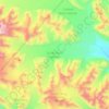
Mapa topográfico Manipur
Haga clic en el mapa para ver la altitud.
Manipur
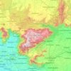
The state lies at a latitude of 23°83'N – 25°68'N and a longitude of 93°03'E – 94°78'E. The total area covered by the state is 22,327 square kilometres (8,621 sq mi). The capital lies in an oval-shaped valley of approximately 700 square miles (2,000 km2), surrounded by blue mountains, at an elevation of 790 metres (2,590 ft) above sea level. The slope of the valley is from north to south. The mountain ranges create a moderated climate, preventing the cold winds from the north from reaching the valley and barring cyclonic storms.
Acerca de este mapa

Nombre: Mapa topográfico Manipur, altitud, relieve.
Lugar: Manipur, India (23.83362 92.97071 25.69210 94.74524)
Altitud media: 810 m
Altitud mínima: 19 m
Altitud máxima: 2.997 m
Otros mapas topográficos
Haga clic en un mapa para ver su topografía, su altitud y su relieve.

Udaipur
India > Rajasthan > Girwa Tehsil
Udaipur is located at 24°31′30″N 73°40′38″E / 24.525049°N 73.677116°E / 24.525049; 73.677116. The city covers an area of 64 km2 (25 sq mi) and lies at an altitude of 598.00 m (1,962 ft) above sea level. It is located in the southern region of Rajasthan, near the Gujarat border. The city…
Altitud media: 656 m
Maharashtra
Maharashtra is the third largest state by area in India. The Western Ghats better known as Sahyadri, are a hilly range running parallel to the coast, at an average elevation of 1,200 metres (4,000 ft). Kalsubai, a peak in the Sahyadris, near Nashik city is the highest elevated point in Maharashtra. To the west…
Altitud media: 478 m
Bhubaneshwar
India > Odisha > Bhubaneswar (M.Corp.)
Bhubaneswar is in Khordha district of Odisha. It is in the eastern coastal plains, along the axis of the Eastern Ghats mountains. The city has an average altitude of 45 m (148 ft) above sea level. It lies southwest of the Mahanadi River that forms the northern boundary of Bhubaneswar metropolitan area, within…
Altitud media: 30 m

Nainital
India > Uttarakhand > Nainital
The city of Nainital covers a total area of 11.73 km2 (4.53 sq mi), and is located at 29°23′N 79°27′E / 29.38°N 79.45°E / 29.38; 79.45, at an average elevation of 2,084 metres (6,837 ft) above sea level. The slopes of the nearby mountains are most populated, with an elevation ranging from…
Altitud media: 1.813 m
Chennai
Chennai is located on the south–eastern coast of India in the north–eastern part of Tamil Nadu on a flat coastal plain known as the Eastern Coastal Plains. Its average elevation is around 6.7 metres (22 ft), and its highest point is 60 m (200 ft). Chennai is 2,184 kilometres (1,357 mi) south of Delhi,…
Altitud media: 7 m
Kakinada
India > Andhra Pradesh > Kakinada (Urban)
Kakinada is located at 16°56′N 82°13′E / 16.93°N 82.22°E / 16.93; 82.22. The 82-degrees east longitude passes through the city. It has an average elevation of 2 metres (6 ft), and many areas of the city are below sea level.
Altitud media: 7 m


Varanasi
India > Uttar Pradesh > Sadar
Varanasi is located at an elevation of 80.71 metres (264.8 ft) in the centre of the Ganges valley of North India, in the Eastern part of the state of Uttar Pradesh, along the left crescent-shaped bank of the Ganges, averaging between 15 metres (50 ft) and 21 metres (70 ft) above the river. The city is the…
Altitud media: 77 m
Vadodara
India > Gujarat > Vadodara Rural Taluka
Vadodara is located at 22°18′N 73°11′E / 22.30°N 73.19°E / 22.30; 73.19 in western India at an elevation of 39 metres (128 ft). It is the tenth-largest city in India with an area of 400 square kilometres (150 sq mi) and a population of 3.5 million, according to the 2010–11 census. The city…
Altitud media: 36 m

Lonavala
India > Maharashtra > Mawal
Adjacent to the Lohagad fort lies the visapur fort which is part of the Lohagad-Visapur fortification. Visapur Fort is larger and at a higher elevation than its twin- Lohagad. It was built during 1713-1720 CE by Balaji Vishwanath.
Altitud media: 613 m

Vellarada
India > Kerala > Neyyattinkara
Vellarada is also known for its hilltop shrine "Kurisumala Pilgrim Centre" (also called Thekkan kurisumala) at an elevation of 640 metres (2,100 ft). Thousands of devotees from various parts of Tamil Nadu, Kerala, Andhra Pradesh and Karnataka visit the shrine during Lent every year.
Altitud media: 124 m
Lucknow
India > Uttar Pradesh > Lucknow
Lucknow stands at an elevation of approximately 123 metres (404 ft) above sea level. The city had an area of 402 km2 (155 square miles) until December 2019, when 88 villages were added to the municipal limits and the area increased to 631 km2 (244 square miles). Bounded on the east by Barabanki, on the west by…
Altitud media: 120 m

Mirzapur
India > Uttar Pradesh > Mirzapur
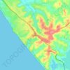
Mirzapur is located at 25°09′N 82°35′E / 25.15°N 82.58°E / 25.15; 82.58. It has an average elevation of 80 metres (265 feet). The District of Mirzapur lies between the parallels of 23.52 & 25.32 North latitude and 82.7 and 83.33 East longitude. It forms a portion of the Varanasi district. On…
Altitud media: 83 m


Bengaluru
India > Karnataka > Bangalore North
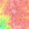
Bengaluru lies in the southeast of the South Indian state of Karnataka in the heart of the Mysore Plateau (a region of the larger Deccan Plateau) at an average elevation of 900 m (2,953 ft). The city covers an area of 741 km2 (286 sq mi). The Bengaluru metropolitan region covers an area of 7,005 km2 (2,705 sq…
Altitud media: 879 m




Pimpri-Chinchwad
India > Maharashtra > Haveli Subdistrict
Pimpri-Chinchwad also known as "PCMC", is a city in the Indian state of Maharashtra. The city is about 15 km (9.3 mi) northwest of the historic city of Pune, at an altitude of 590 m (1,940 ft) above sea level. It is the fifth largest city in Maharashtra and the nineteenth largest city in India and the…
Altitud media: 605 m

Tirunelveli
India > Tamil Nadu > Palayamkottai
Tirunelveli is located at 8°43′41.82″N 77°41′43.94″E / 8.7282833°N 77.6955389°E / 8.7282833; 77.6955389, and its average elevation is 47 metres (154 ft). It is located at the southernmost tip of the Deccan plateau. The Tamirabarani River divides the city into the Tirunelveli quarter and…
Altitud media: 34 m


Panvel
India > Maharashtra > Panvel > Panvel
Matheran is a hill station and a municipal council in the Raigad district in the Indian state of Maharashtra. It is a hill station in Karjat Tahsil and is also the smallest hill station in India. It is located on the Western Ghats range at an elevation of around 800 m (2,625 feet) above sea level. It is…
Altitud media: 75 m


Dharamshala
India > Himachal Pradesh > Dharamshala
Dharamshala has an average elevation of 1,457 m (4,780 ft), covering an area of almost 8.51 km2 (3.29 sq mi). Dharamsala is located in the Kangra Valley, in the shadow of the Dhauladhar mountains.
Altitud media: 1.781 m
Mysuru
India > Karnataka > Mysuru taluk
Mysore (/maɪˈsɔːr/ (listen)), officially Mysuru ([ˈmaɪˈsuːɾu] (listen)), is a city in the southern part of the state of Karnataka, India. Mysore city is geographically located between 12° 18′ 26″ north latitude and 76° 38′ 59″ east longitude. It is located at an altitude of 770 m (2,530 ft)…
Altitud media: 727 m
Thiruvananthapuram
India > Kerala > Thiruvananthapuram
Thiruvananthapuram is built on seven hills by the seashore and is at 8°30′N 76°54′E / 8.5°N 76.9°E / 8.5; 76.9 on the west coast, near the southern tip of mainland India. The city is on the west coast of India and is bounded by the Laccadive Sea to its west and the Western Ghats to its east.…
Altitud media: 33 m

Neyveli
India > Tamil Nadu > Virudhachalam
Neyveli is located at 11°36′N 79°29′E / 11.60°N 79.48°E / 11.60; 79.48. It has an average elevation of 87 metres (285 ft). It is located along with the Chennai-Thanjavur National Highway. Neyveli was a planned township and is sub-divided into 'blocks'. There are 32 blocks with each block…
Altitud media: 23 m

Madikeri
India > Karnataka > Madikeri taluku
Madikeri features a tropical highland climate as it has an elevation of 1,170 m (3,840 ft). Madikeri is located at 12°25′N 75°44′E / 12.42°N 75.73°E / 12.42; 75.73. Madikeri lies in the Western Ghats and is a popular hill station. The nearest cities are Hassan to the north, Mangaluru to the…
Altitud media: 1.054 m
Madurai
India > Tamil Nadu > Madurai
Madurai is located at 9°56′N 78°07′E / 9.93°N 78.12°E / 9.93; 78.12. It has an average elevation of 101 metres. The city of Madurai lies on the flat and fertile plain of the river Vaigai, which runs in the northwest-southeast direction through the city, dividing it into two almost equal…
Altitud media: 138 m


Chikkaballapura
India > Karnataka > Chikkaballapura taluk
Chikkaballapur has a high elevation located in the center of the Nandi Hills region. "Panchagiri" is a common descriptor of Chikkaballapur as it is surrounded by 5 hills, among which Nandi Hill is the most famous. (the five hills are Nandi Giri, Chandra Giri, Skandagiri, Brahma Giri, and Hema Giri).
Altitud media: 929 m
Nilambur
The 2,554 m (8,379 ft) m high Mukurthi peak, which is situated in the border of Nilambur Taluk and Ooty Taluk, and is also the fifth-highest peak in South India as well as the third-highest in Kerala after Anamudi (2,696 m [8,845 ft]) and Meesapulimala (2,651 m [8,698 ft]), is the highest point of elevation in…
Altitud media: 33 m

Bengaluru
India > Karnataka > Bangalore North
Bengaluru lies in the southeast of the South Indian state of Karnataka in the heart of the Mysore Plateau (a region of the larger Deccan Plateau) at an average elevation of 900 m (2,953 ft). The city covers an area of 741 km2 (286 sq mi). The Bengaluru metropolitan region covers an area of 7,005 km2 (2,705 sq…
Altitud media: 879 m

Dakshina Kannada
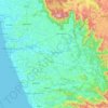
The topography of the district is plain up to 30 km (18.64 mi) inside the coast and changes to undulating hilly terrain sharply towards the east in the Western Ghats. Teak, bamboo and rosewood trees are found in the hilly areas towards the east. The Geological Survey of India has identified this district as a…
Altitud media: 109 m


Bhilai
India > Chhattisgarh > Durg Tahsil
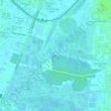
Bhilai lies at 21.21°N 81.38°E in Central India at an elevation of 297m above sea level on the banks of the Shivnath river, a tributary of the river Mahanadi. It covers an area of 341 km2 (132 sq mi).
Altitud media: 292 m

Krishnanagar
India > West Bengal > Krishnagar-I
Krishnanagar is located at 23°24′N 88°30′E / 23.4°N 88.5°E / 23.4; 88.5. The area of the municipality is around 16 km2. It is situated on the southern banks of the Jalangi River. It has an average elevation of 14 metres (46 ft). The Tropic of Cancer passes through the outskirts of…
Altitud media: 11 m

Kolkata
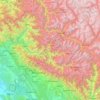
Spread roughly north–south along the east bank of the Hooghly River, Kolkata sits within the lower Ganges Delta of eastern India approximately 75 km (47 mi) west of the international border with Bangladesh; the city's elevation is 1.5–9 m (5–30 ft). Much of the city was originally a wetland that was…
Altitud media: 5 m


Hunsur
India > Karnataka > Hunasuru taluk
Hunsur is located at 12°19′N 76°17′E / 12.31°N 76.29°E / 12.31; 76.29. It is located at an elevation of 805 metres (2,641 ft) above mean sea level. The river Lakshmana Tirtha flows through the town and two bridges are built across the river. The town is the administrative center of Hunsur…
Altitud media: 792 m




Milam Glacier
India > Uttarakhand > Munsiari tehsil
Milam Glacier, covering around 37 km2 (14 sq mi) area of 16 km (10 mi) length, is located about 15 kilometres (9 mi) northeast of Nanda Devi. It ranges in elevation from about 5,500 metres (18,000 ft) to about 3,870 metres (12,700 ft) at its snout. Situated on the south facing slope of the main Great Himalayas…
Altitud media: 5.229 m