Mapa topográfico Spring Gap Mountain
Haga clic en el mapa para ver la altitud.
Spring Gap Mountain
Spring Gap Mountain runs southwest northeast through Morgan and Hampshire counties in West Virginia's Eastern Panhandle, rising to its greatest elevation of 2,237 ft (682 m) north of "Spring Gap", from which the mountain takes its name. The gap is the source for Dug Hill Run, a tributary stream of the Little Cacapon River.
Acerca de este mapa
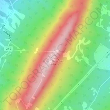
Nombre: Mapa topográfico Spring Gap Mountain, altitud, relieve.
Altitud media: 468 m
Altitud mínima: 315 m
Altitud máxima: 665 m
Otros mapas topográficos
Haga clic en un mapa para ver su topografía, su altitud y su relieve.