
Mapa topográfico Texas City
Mapa interactivo
Haga clic en el mapa para ver la altitud.
Acerca de este mapa
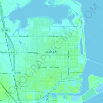
Nombre: Mapa topográfico Texas City, altitud, relieve.
Lugar: Texas City, Galveston County, Texas, 77590, United States (29.35601 -94.95755 29.43601 -94.87755)
Altitud media: 3 m
Altitud mínima: -4 m
Altitud máxima: 14 m
Officially, the elevation of Texas City is 10 feet above sea level, though some areas are even lower. It was naturally vulnerable to flooding by hurricane storm surges and heavy rainstorms.