
Mapa topográfico Jinggang Mountains Nature Reserve
Mapa interactivo
Haga clic en el mapa para ver la altitud.
Acerca de este mapa
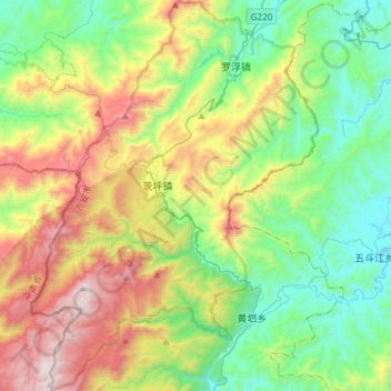
Nombre: Mapa topográfico Jinggang Mountains Nature Reserve, altitud, relieve.
Altitud media: 749 m
Altitud mínima: 209 m
Altitud máxima: 1.816 m
The range lies at the junction of four counties - Ninggang, Yongxing, Suichuan and Lingxian. The mountains cover some 670 km2 (260 sq mi), with an average elevation of 381.5 metres (1,252 ft) above sea level. The highest point is 2,120 m (6,960 ft) above sea level.