Geolocalizar

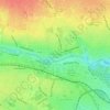
Mapa topográfico Bluebell

Haga clic en el mapa para ver la altitud.

Acerca de este mapa

Nombre: Mapa topográfico Bluebell, altitud, relieve.

Lugar: Bluebell, Inchicore B Ward 1986, Dublin, County Dublin, Leinster, Ireland (53.32467 -6.35922 53.33431 -6.32840)

Altitud media: 44 m

Altitud mínima: 20 m

Altitud máxima: 66 m

Otros mapas topográficos

Haga clic en un mapa para ver su topografía, su altitud y su relieve.
Dublin Castle

Ireland > County Dublin > Dublin

The Poddle was diverted into the city through archways where the walls adjoined the castle, artificially flooding the moat of the fortress's city elevations. One of these archways and part of the wall survive buried underneath the 18th-century buildings, and are open for public viewing.

Altitud media: 16 m

Iveagh Gardens

Ireland > County Dublin > Dublin

Altitud media: 17 m

Griffith Park

Ireland > County Dublin > Dublin

Altitud media: 26 m

St Anne's Park

Ireland > County Dublin > Dublin

Altitud media: 13 m

Equípate para tu próxima aventura:

🔋Pilas Recargables - Ahorro y ecología para tus dispositivos de navegación
⌚Relojes GPS de montaña - Relojes con GPS para rutas y desnivel
👖Mallas Térmicas Hombre - Capa base para mantener las piernas calientes
🛡️Fundas Impermeables para Mochila - Mantén tu equipo y mapas secos bajo cualquier tormenta
🧢Gorras de Montaña - Protección contra los rayos UV en cumbres despejadas

Como asociado de Amazon, este sitio gana comisiones por las compras que califican, sin ningún costo adicional para usted.