
Mapa topográfico York
Mapa interactivo
Haga clic en el mapa para ver la altitud.
York
According to the United States Census Bureau, the town has a total area of 131.78 square miles (341.31 km2), of which 54.67 square miles (141.59 km2) is land and 77.11 square miles (199.71 km2) is water. The York watershed drains into the York River. The highest point in town is Mount Agamenticus, with an elevation of 692 feet (211 meters) above sea level. A road travels to the summit, where miles of hiking, biking and horse-riding trails are available. The lowest point in town is sea level, along the coastline with the Atlantic Ocean. York lies about 44 miles (71 km) south of Portland, 98 miles (158 km) south of Augusta, and 65 miles (105 km) north of Boston.
Acerca de este mapa
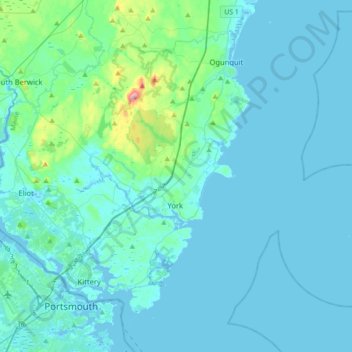
Nombre: Mapa topográfico York, altitud, relieve.
Lugar: York, York County, Maine, United States (43.07006 -70.75739 43.26087 -70.40476)
Altitud media: 18 m
Altitud mínima: -6 m
Altitud máxima: 206 m
Otros mapas topográficos
Haga clic en un mapa para ver su topografía, su altitud y su relieve.