
Mapa topográfico East Shelburne
Mapa interactivo
Haga clic en el mapa para ver la altitud.
Acerca de este mapa
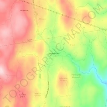
Nombre: Mapa topográfico East Shelburne, altitud, relieve.
Altitud media: 270 m
Altitud mínima: 95 m
Altitud máxima: 398 m
Otros mapas topográficos
Haga clic en un mapa para ver su topografía, su altitud y su relieve.
Shelburne Falls
United States > Massachusetts > Franklin County > Shelburne
Shelburne Falls, Shelburne, Franklin County, Massachusetts, 01370, United States
Altitud media: 225 m