
Mapa topográfico Great Neva
Mapa interactivo
Haga clic en el mapa para ver la altitud.
Acerca de este mapa
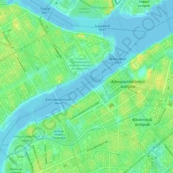
Nombre: Mapa topográfico Great Neva, altitud, relieve.
Altitud media: 8 m
Altitud mínima: -2 m
Altitud máxima: 20 m
The Neva flows out of Lake Ladoga near Shlisselburg, flows through Neva's lowlands and discharges into the Baltic Sea in the Gulf of Finland. It has a length of 74 kilometres (46 mi), and the shortest distance from the source to the mouth is 45 kilometres (28 mi). The river banks are low and steep, on average about 3 to 6 metres (10 to 20 ft) and 2 to 3 metres (7 to 10 ft) at the mouth. There are three sharp turns: the Ivanovskye rapids, at Nevsky Forest Park of the Ust-Slavyanka region (the so-called "Crooked Knee"), and near the Smolny Institute, below the mouth of the river Okhta. The river declines 4.27 metres (14.0 ft) in elevation between source and mouth. At one point the river crosses a moraine ridge and forms the Ivanovskye rapids. There, at the beginning of the rapids, is the narrowest part of the river: 210 metres (690 ft). The average flow rate in the rapids is about 0.8–1.1 metres per second (2.6–3.6 ft/s). The average width along the river is 400 to 600 metres (1,300 to 2,000 ft). The widest places, at 1,000 to 1,250 metres (3,280 to 4,100 ft), are in the delta, near the gates of the marine trading port, at the end of the Ivanovskye rapids near the confluence of the river Tosna, and near the island Fabrinchny near the source. The average depth is 8 to 11 metres (26 to 36 ft); the maximum of 24 metres (79 ft) is reached above the Liteyny Bridge, and the minimum of 4.0 to 4.5 metres (13 to 15 ft) is in Ivanovskye rapids.
Otros mapas topográficos
Haga clic en un mapa para ver su topografía, su altitud y su relieve.
Great Neva
Russia > Saint Petersburg > Saint Petersburg
Great Neva, Palace District, Saint Petersburg, Northwestern Federal District, 190107, Russia
Altitud media: 8 m
Saint Petersburg
Russia > Saint Petersburg > Saint Petersburg
Saint Petersburg, Northwestern Federal District, 191186, Russia
Altitud media: 14 m