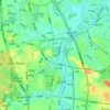
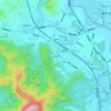
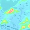
Mapa topográfico Yingde City
Haga clic en el mapa para ver la altitud.
Acerca de este mapa

Nombre: Mapa topográfico Yingde City, altitud, relieve.
Lugar: Yingde City, Qingyuan City, Guangdong, 513000, China (23.84577 112.75519 24.55055 113.92617)
Altitud media: 283 m
Altitud mínima: 5 m
Altitud máxima: 1.663 m
Otros mapas topográficos
Haga clic en un mapa para ver su topografía, su altitud y su relieve.


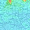


Mount Yangtai
The Mount Yangtai (Chinese: 羊台山; pinyin: Yángtaíshān), also known as Mount Yangtai Forest Park, is a mountain at the junction of Bao'an District and Nanshan District in Shenzhen, Guangdong, China. The peak is 587.3 metres (1,927 ft) in elevation, which is the highest peak in western Shenzhen. In 2008…
Altitud media: 287 m