
Mapa topográfico Weststellingwerf
Mapa interactivo
Haga clic en el mapa para ver la altitud.
Acerca de este mapa
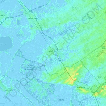
Nombre: Mapa topográfico Weststellingwerf, altitud, relieve.
Lugar: Weststellingwerf, Friesland, Niederlande (52.80072 5.81811 52.94301 6.24726)
Altitud media: 2 m
Altitud mínima: -5 m
Altitud máxima: 20 m