
Mapa topográfico Wilmington
Mapa interactivo
Haga clic en el mapa para ver la altitud.
Acerca de este mapa
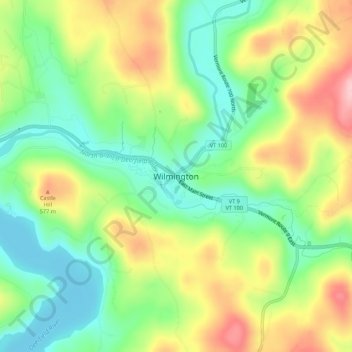
Nombre: Mapa topográfico Wilmington, altitud, relieve.
Lugar: Wilmington, Windham County, Vermont, 05363, United States (42.84852 -72.89102 42.88852 -72.85102)
Altitud media: 515 m
Altitud mínima: 441 m
Altitud máxima: 620 m
Wilmington experiences a humid continental climate (Koppen Dfb) with warm, humid summers and cold (sometimes severely cold) winters. While snowfall can vary greatly from year to year in nearby towns like Bennington and Brattleboro, Wilmington's snowfall is consistently heavy each year because of its elevation in the Green Mountains' high country.