
Mapa topográfico Kill Devil Hills
Mapa interactivo
Haga clic en el mapa para ver la altitud.
Acerca de este mapa
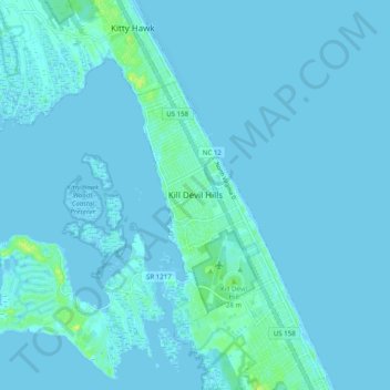
Nombre: Mapa topográfico Kill Devil Hills, altitud, relieve.
Altitud media: 1 m
Altitud mínima: -4 m
Altitud máxima: 15 m
First Flight Airport covers an area of 40 acres at an elevation of 13 feet (4 metres) above mean sea level. It has one runway; designated 2/20, with an asphalt surface measuring 3,000 by 60 feet (914 by 18 metres). For the 12-month period ending August 19, 2009, the airport had 38,120 aircraft operations, an average of 104 per day: 97% general aviation, 3% air taxi, and <1% military.