
Mapa topográfico Amur River
Mapa interactivo
Haga clic en el mapa para ver la altitud.
Acerca de este mapa
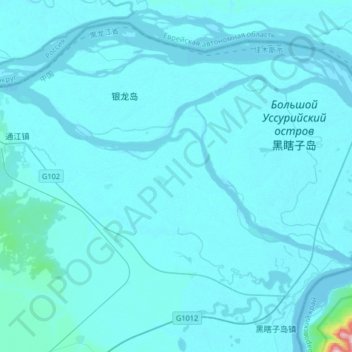
Nombre: Mapa topográfico Amur River, altitud, relieve.
Altitud media: 43 m
Altitud mínima: 33 m
Altitud máxima: 361 m
The river rises in the hills in the western part of Northeast China at the confluence of its two major affluents, the Shilka River and the Ergune (or Argun) River, at an elevation of 303 metres (994 ft). It flows east forming the border between China and Russia, and slowly makes a great arc to the southeast for about 400 kilometres (250 mi), receiving many tributaries and passing many small towns. At Huma, it is joined by a major tributary, the Huma River. Afterwards it continues to flow south until between the cities of Blagoveschensk (Russia) and Heihe (China), it widens significantly as it is joined by the Zeya River, one of its most important tributaries.