

Mapa topográfico Tholing town
Haga clic en el mapa para ver la altitud.
Tholing town
Recent maps only use the Zanda name, and not Tholing. Zanda sits at an elevation of 3,660 metres (12,010 ft). There are caves in the hills, and a few ruins of chortens located closer to the Sutlej River; the ruins are mostly destroyed but the murals are in very good condition. There are a few poplar trees in the town. A large army establishment is at the southern end of town whereas the Tibetan village is at the northern end of the town. There are a few guest houses between these two locations. The road to Zanda passes through very high snow-covered mountain ranges (in the elevation range of 5,200–5,500 metres (17,100–18,000 ft) along steep slopes and in the descent it passes through the canyon, crosses the Sutlej River at a bridge, and passes through a dry river bed before reaching Zanda.
Acerca de este mapa
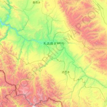
Nombre: Mapa topográfico Tholing town, altitud, relieve.
Lugar: Tholing town, Tsamda County, Ngari Prefecture, Xizang, China (30.93881 79.22052 31.83600 80.30665)
Altitud media: 4.737 m
Altitud mínima: 3.403 m
Altitud máxima: 7.294 m