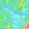
Mapa topográfico Bath
Haga clic en el mapa para ver la altitud.
Bath
George Washington, his family members, and several colonial elites were among the town's first landowners. The town's main north-south street was named Washington, and the main east-west street was named Fairfax. Also, four acres were set aside for "suffering humanity." The area around the springs always was public land known as The Grove and overseen by a state-appointed group of Beth Trustees. This would become Berkeley Springs State Park with its springs and bathhouses, which was made part of the West Virginia state park system in 1925. Nearby, Cacapon State Park was opened in 1933. The mountain that gives its name to the park has an elevation of 2,320 feet (710 m) above sea level.
Acerca de este mapa

Nombre: Mapa topográfico Bath, altitud, relieve.
Lugar: Bath, Morgan County, West Virginia, United States (39.61694 -78.23571 39.63443 -78.22160)
Altitud media: 232 m
Altitud mínima: 177 m
Altitud máxima: 328 m
Otros mapas topográficos
Haga clic en un mapa para ver su topografía, su altitud y su relieve.