
Haz una donación
Equípate para tu próxima aventura:
Como asociado de Amazon, este sitio gana comisiones por las compras que califican, sin ningún costo adicional para usted.
Mapa topográfico Garding
Haga clic en el mapa para ver la altitud.
Haz una donación
Equípate para tu próxima aventura:
Como asociado de Amazon, este sitio gana comisiones por las compras que califican, sin ningún costo adicional para usted.
Garding
Die St.-Christians-Kirche steht im historischen Stadtzentrum auf einer natürlichen Anhöhe. Die Topographische Karte weist für diesen Standort eine Höhenlage von 9 m über NHN aus. Es ist der Höchste Punkt innerhalb des Stadtgebiets. Die Altstadt ist um die Kirche herum gruppiert. Das Straßennetz ist hier sternförmig auf das Kirchenbauwerk ausgerichtet.
Haz una donación
Equípate para tu próxima aventura:
Como asociado de Amazon, este sitio gana comisiones por las compras que califican, sin ningún costo adicional para usted.
Acerca de este mapa
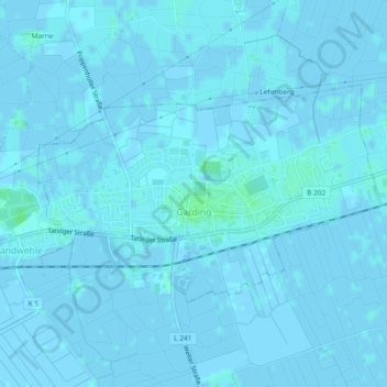
Nombre: Mapa topográfico Garding, altitud, relieve.
Altitud media: 0 m
Altitud mínima: -3 m
Altitud máxima: 5 m
Haz una donación
Equípate para tu próxima aventura:
Como asociado de Amazon, este sitio gana comisiones por las compras que califican, sin ningún costo adicional para usted.
Otros mapas topográficos
Haga clic en un mapa para ver su topografía, su altitud y su relieve.
Wenningstedt
Deutschland > Schleswig-Holstein > Nordfriesland
Wenningstedt bildet aufgrund seiner erheblich höheren Einwohner- und Gästebettenzahl das Zentrum der Gemeinde mit Gemeindebüro, Kurverwaltung und Einzelhandel.
Altitud media: 10 m