
Mapa topográfico Rusava
Mapa interactivo
Haga clic en el mapa para ver la altitud.
Acerca de este mapa
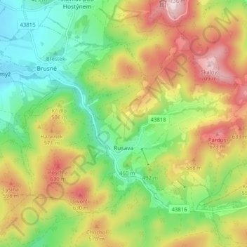
Nombre: Mapa topográfico Rusava, altitud, relieve.
Altitud media: 482 m
Altitud mínima: 301 m
Altitud máxima: 722 m
Rusava is located in the Hostýn Hills. The highest point of the municipality is top of the Skalný mountain with an elevation of 709 metres (2,326 ft).