

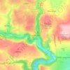
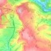
Mapa topográfico Elton
Haga clic en el mapa para ver la altitud.
Elton
At 271 metres (889 ft) above sea level, Elton is less sheltered from the wind than settlements at lower elevation, and it therefore has a reputation for being cold. The highest point on Elton Moor, known as Blake Low, is 330 metres (1,080 ft) above sea level; at this location is Elton Common trig point (TP3057). There is an interpretation board here that explains how the landscape has changed from the past mining activities and points out the effects on a scarred adjacent field. It shows notable points of the Peak District that can be seen from this viewpoint, including Kinder Scout and Mam Tor, some distance away. It states how this is one of the best viewpoints of the Peak District.
Acerca de este mapa

Nombre: Mapa topográfico Elton, altitud, relieve.
Altitud media: 268 m
Altitud mínima: 178 m
Altitud máxima: 331 m
Otros mapas topográficos
Haga clic en un mapa para ver su topografía, su altitud y su relieve.

Hallam Moors
United Kingdom > England > Derbyshire > Derbyshire Dales > Hathersage
Altitud media: 368 m

Slaley
United Kingdom > England > Derbyshire > Derbyshire Dales > Matlock > Bonsall CP
Altitud media: 263 m
Bolehill
United Kingdom > England > Derbyshire > Derbyshire Dales > Wirksworth CP
Altitud media: 220 m


Riber Castle
United Kingdom > England > Derbyshire > Derbyshire Dales > Matlock > Starkholmes
Altitud media: 169 m

Breamfield
United Kingdom > England > Derbyshire > Derbyshire Dales > Wirksworth CP > Breamfield
Altitud media: 213 m
Curbar Edge
United Kingdom > England > Derbyshire > Derbyshire Dales > Calver Sough
Altitud media: 251 m
Coplow Dale
United Kingdom > England > Derbyshire > Derbyshire Dales > Little Hucklow
Altitud media: 333 m
Stoke Brook
United Kingdom > England > Derbyshire > Derbyshire Dales > Calver Sough
Altitud media: 197 m
Monsal Head
United Kingdom > England > Derbyshire > Derbyshire Dales > Cressbrook > Monsal Head
Altitud media: 231 m
Yarncliff Wood
United Kingdom > England > Derbyshire > Derbyshire Dales > Grindleford
Altitud media: 260 m

Calver Sough
United Kingdom > England > Derbyshire > Derbyshire Dales > Calver Sough
Altitud media: 218 m
Parsley Hay
United Kingdom > England > Derbyshire > Derbyshire Dales > Parsley Hay
Altitud media: 334 m
Longstone Edge
United Kingdom > England > Derbyshire > Derbyshire Dales > Rowland
Altitud media: 290 m


Longcliffe
United Kingdom > England > Derbyshire > Derbyshire Dales > Brassington CP
Altitud media: 299 m

Lathkill Dale
United Kingdom > England > Derbyshire > Derbyshire Dales > Youlgreave
Altitud media: 269 m

Two Dales
United Kingdom > England > Derbyshire > Derbyshire Dales > Darley Dale > Darley Hillside
Altitud media: 189 m


Magpie Mine
United Kingdom > England > Derbyshire > Derbyshire Dales > Ashford in the Water CP
Altitud media: 303 m


Catcliff Wood
United Kingdom > England > Derbyshire > Derbyshire Dales > Bakewell CP
Altitud media: 173 m


Taddington Dale
United Kingdom > England > Derbyshire > Derbyshire Dales > Brushfield CP
Altitud media: 281 m

Cressbrook Dale
United Kingdom > England > Derbyshire > Derbyshire Dales > Litton CP > Litton Mill
Altitud media: 286 m



Hathersage Booths
United Kingdom > England > Derbyshire > Derbyshire Dales > Hathersage
Altitud media: 260 m
Stanage Plantation
United Kingdom > England > Derbyshire > Derbyshire Dales > Hathersage
Altitud media: 360 m
Black Rocks
United Kingdom > England > Derbyshire > Derbyshire Dales > Cromford CP
Altitud media: 199 m

Padley Gorge
United Kingdom > England > Derbyshire > Derbyshire Dales > Grindleford
Altitud media: 316 m


Horseshoe Quarry
United Kingdom > England > Derbyshire > Derbyshire Dales > Eyam CP
Altitud media: 293 m

Breamfield
United Kingdom > England > Derbyshire > Derbyshire Dales > Wirksworth CP
Altitud media: 213 m
Padley Gorge
United Kingdom > England > Derbyshire > Derbyshire Dales > Grindleford
Altitud media: 316 m
Wirksworth Moor
United Kingdom > England > Derbyshire > Derbyshire Dales > Wirksworth CP
Altitud media: 207 m