
Mapa topográfico Sisak
Mapa interactivo
Haga clic en el mapa para ver la altitud.
Acerca de este mapa
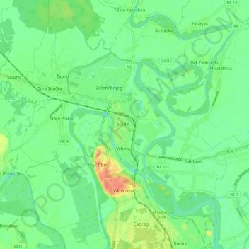
Nombre: Mapa topográfico Sisak, altitud, relieve.
Lugar: Sisak, Grad Sisak, Sisak-Moslavina County, 44000, Croatia (45.44883 16.33548 45.52883 16.41548)
Altitud media: 98 m
Altitud mínima: 83 m
Altitud máxima: 127 m
Sisak (Croatian: ; Hungarian: Sziszek ; also known by other alternative names) is a city and episcopal see in central Croatia, located at the confluence of the Kupa, Sava and Odra rivers, 57 km (35 mi) southeast of the Croatian capital Zagreb, and is usually considered to be where the Posavina (Sava basin) begins, with an elevation of 99 m. The city's total population in 2011 was 47,768 of which 33,322 live in the urban settlement (naselje).
Otros mapas topográficos
Haga clic en un mapa para ver su topografía, su altitud y su relieve.