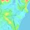
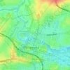
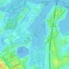
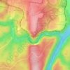
Mapa topográfico Wakeley
Haga clic en el mapa para ver la altitud.
Wakeley
In 1964, the Australian Oil and Gas Corporation drilled the Fairfield-1 exploratory well in what is now Esperance Reserve, as part of petroleum exploration of the Sydney Basin. The well was located at approximately 33°52′16″S 150°54′54″E / 33.8711°S 150.9150°E / -33.8711; 150.9150, at a ground elevation of 22.3 m (73 ft), and reached a total depth of 855.3 m (2,806 ft) below ground level.
Acerca de este mapa

Nombre: Mapa topográfico Wakeley, altitud, relieve.
Lugar: Wakeley, Sydney, New South Wales, 2176, Australia (-33.88230 150.90075 -33.86536 150.91657)
Altitud media: 31 m
Altitud mínima: 15 m
Altitud máxima: 56 m
Otros mapas topográficos
Haga clic en un mapa para ver su topografía, su altitud y su relieve.



































Bents Basin State Conservation Area
Australia > New South Wales > Sydney
The park is popular for swimming, kayaking, bushwalking, camping (with 100 tent sites), barbecuing, picnicking and fishing. The park also features walking trails within a bushland and an education centre with a commercial kitchen. Caley's Lookout Track, a walking track within the bushland, leads to Little…
Altitud media: 82 m