
Mapa topográfico Aizawl
Mapa interactivo
Haga clic en el mapa para ver la altitud.
Aizawl
Aizawl has a mild, sub-tropical climate due to its location and elevation. Under the Köppen climate classification, Aizawl features a humid subtropical climate (Cwa). In summer, temperatures are moderately warm, averaging around 20–30 °C (68–86 °F). In winter, daytime temperatures are cooler in comparison to the rest of the year, averaging around 11–21 °C (52–70 °F). Rainfall is mostly concentrated between April and October, with the heaviest rainfall occurring in May, July, August and September. The remainder of the year is notably drier.
Acerca de este mapa
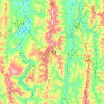
Nombre: Mapa topográfico Aizawl, altitud, relieve.
Lugar: Aizawl, Tlangnuam, Aizawl, 796190, India (23.58335 92.57828 23.90335 92.89828)
Altitud media: 556 m
Altitud mínima: 60 m
Altitud máxima: 1.509 m