Geolocalizar

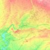
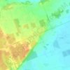
Mapa topográfico Huron County

Haga clic en el mapa para ver la altitud.

Acerca de este mapa

Nombre: Mapa topográfico Huron County, altitud, relieve.

Lugar: Huron County, Southwestern Ontario, Ontario, Canada (43.23650 -81.77737 44.05562 -80.95440)

Altitud media: 274 m

Altitud mínima: 173 m

Altitud máxima: 402 m

Otros mapas topográficos

Haga clic en un mapa para ver su topografía, su altitud y su relieve.
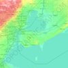
Toronto

Canada > Ontario > Toronto

Despite its deep ravines, Toronto is not remarkably hilly, but its elevation does increase steadily away from the lake. Elevation differences range from 76.5 metres (251 ft) above sea level at the Lake Ontario shore to 209 m (686 ft) ASL near the York University grounds in the city's north end at the…

Altitud media: 113 m
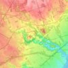
Guelph

Canada > Ontario > Guelph

This region of Ontario has cold winters and warm, humid summers, falling into the Köppen climate classification Dfb zone, with moderately high rainfall and snowfall. It is generally a couple of degrees cooler than lower elevation regions on the Great Lakes shorelines, especially so in winter, the exception…

Altitud media: 344 m
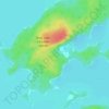
Hamilton

Canada > Ontario > Hamilton

Altitud media: 181 m

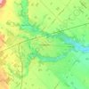
Windsor

Canada > Ontario > Windsor

Altitud media: 185 m

The Arboretum

Canada > Ontario > Guelph

Victoria Woods is an old-growth hardwood forest made up of sugar maple, white ash, black cherry and beech. Varied topography in this area, which includes a pond, allows for a wide variety of woodland plants to grow here. Spring is an especially nice time to visit Victoria Woods to see many of these spring…

Altitud media: 332 m
London

Canada > Ontario > London > London

London has a humid continental climate (Köppen Dfb), though due to its downwind location relative to Lake Huron and elevation changes across the city, it is virtually on the Dfa/Dfb (hot summer) boundary favouring the former climate zone to the southwest of the confluence of the South and North Thames Rivers,…

Altitud media: 268 m
Peterborough

Canada > Ontario > Peterborough

Peterborough's topography is largely defined by land formations created by the receding Wisconsian glaciers 10,000–15,000 years ago. The South End and Downtown portions of the City sit on what was the bottom of the glacial Lake Peterborough—part of a glacial spillway created when glacial meltwaters from…

Altitud media: 235 m
Niagara Escarpment

Canada > Ontario

Altitud media: 299 m

Kingston

Canada > Ontario > Kingston

Altitud media: 94 m

Dundas

Canada > Ontario > Hamilton > Dundas

Dundas /ˈdʌnˌdæs/ is a community and former town in Hamilton, Ontario, Canada. It is nicknamed the Valley Town because of its topographical location at the bottom of the Niagara Escarpment on the western edge of Lake Ontario. The population has been stable for decades at about twenty thousand, largely…

Altitud media: 171 m
High Park

Canada > Ontario > Toronto

Altitud media: 97 m

Fort Erie

Canada > Ontario > Niagara Region > Fort Erie

Altitud media: 183 m

Ishpatina Ridge

Canada > Ontario > Sudbury District > Unorganized North Sudbury

Ishpatina Ridge is the highest point of land in the Canadian province of Ontario, at an estimated 693 m (2,274 ft) above sea level. Ishpatina Ridge rises approximately 300 m (984 ft) above the immediate area. It was only truly recognized as Ontario's highest point after topographical mapping by the Government…

Altitud media: 545 m
Haliburton

Canada > Ontario

Altitud media: 358 m

Cambridge

Canada > Ontario > Cambridge

Altitud media: 295 m

Crystal Beach

Canada > Ontario > Niagara Region > Fort Erie

Altitud media: 179 m

Niagara Escarpment

Canada > Ontario > Hamilton

Altitud media: 162 m

Navan

Canada > Ontario > Ottawa

Altitud media: 81 m

Ridgetown

Canada > Ontario > Chatham-Kent

Altitud media: 208 m

Chedoke Creek

Canada > Ontario > Hamilton

Altitud media: 93 m

Harrow

Canada > Ontario > Essex County

Altitud media: 189 m

Victoria Harbour

Canada > Ontario > Simcoe County > Tay

Altitud media: 185 m

Kenora

Canada > Ontario

Altitud media: 182 m

Prince Edward

Canada > Ontario

Altitud media: 118 m

Stratford

Canada > Ontario > Stratford

Altitud media: 356 m

Perth

Canada > Ontario

Altitud media: 313 m

Lambton

Canada > Ontario

Altitud media: 188 m

Parry Sound

Canada > Ontario

Altitud media: 235 m

Essex

Canada > Ontario

Altitud media: 193 m

Lac Seul

Canada > Ontario

Altitud media: 365 m

Georgetown

Canada > Ontario > Halton Region

Altitud media: 255 m

Harlem Shoal

Canada > Ontario

Altitud media: 175 m

St. Johns

Canada > Ontario

Altitud media: 205 m

Ottawa

Canada > Ontario > Ottawa > Ottawa

Altitud media: 99 m

Quetico Provincial Park

Canada > Ontario

Altitud media: 432 m

Ohsweken

Canada > Ontario

Altitud media: 208 m

Sagamok

Canada > Ontario

Altitud media: 210 m

Pinehurst Lake

Canada > Ontario

Altitud media: 295 m

Docker Lake

Canada > Ontario

Altitud media: 377 m

Bigwin Island

Canada > Ontario

Altitud media: 328 m

Upper Pergeon Lake

Canada > Ontario

Altitud media: 215 m

York River

Canada > Ontario

Altitud media: 397 m

Batawa

Canada > Ontario > Quinte West

Altitud media: 115 m

Kawartha Lakes (city)

Canada > Ontario

Altitud media: 274 m

Pelee Island

Canada > Ontario

Altitud media: 173 m

Quinte West (city)

Canada > Ontario

Altitud media: 160 m

London

Canada > Ontario

London has a humid continental climate (Köppen Dfb), though due to its downwind location relative to Lake Huron and elevation changes across the city, it is virtually on the Dfa/Dfb (hot summer) boundary favouring the former climate zone to the southwest of the confluence of the South and North Thames Rivers,…

Altitud media: 269 m

Lambton

Canada > Ontario

Altitud media: 191 m

Algoma District

Canada > Ontario

Altitud media: 360 m

London (city)

Canada > Ontario

Altitud media: 239 m

Brantford

Canada > Ontario > Brantford

Altitud media: 238 m

Orillia

Canada > Ontario > Orillia

Altitud media: 236 m

Amherst Island

Canada > Ontario > Loyalist

Altitud media: 77 m

Mount Albert

Canada > Ontario > York Region

Altitud media: 261 m

Port Perry

Canada > Ontario > Durham Region > Scugog

Altitud media: 263 m

Sioux Lookout

Canada > Ontario > Kenora District

Altitud media: 363 m

Toronto Islands

Canada > Ontario > Toronto

Altitud media: 123 m

Fenelon Falls

Canada > Ontario > Kawartha Lakes

Altitud media: 269 m

Don River

Canada > Ontario > Toronto

Altitud media: 80 m

Horseshoe Lake

Canada > Ontario > Seguin

Altitud media: 244 m

Simcoe

Canada > Ontario > Norfolk County

Altitud media: 227 m

Sand Lake

Canada > Ontario > Sand Lake

Altitud media: 370 m

Colpoy's Bay

Canada > Ontario > Bruce County

Altitud media: 202 m

Blueberry Hill

Canada > Ontario > Whitestone

Altitud media: 242 m

Muskrat Lake

Canada > Ontario > Renfrew County > Cobden

Altitud media: 146 m

Pikangikum

Canada > Ontario > Kenora District

Altitud media: 333 m

Collingwood

Canada > Ontario > Simcoe County > Collingwood

Altitud media: 188 m

Alban

Canada > Ontario > Sudbury District > French River

Altitud media: 206 m

Duffins Creek

Canada > Ontario > Durham Region > Ajax

Altitud media: 88 m

St George

Canada > Ontario > Brant County

Altitud media: 241 m

Mooretown

Canada > Ontario > Lambton County > St. Clair

Altitud media: 187 m

Newcastle

Canada > Ontario > Durham Region > Clarington

Altitud media: 109 m

Equípate para tu próxima aventura:

🪵Hornillos de camping - Cocina portátil para exterior
🥾Polainas de senderismo - Protección contra barro y nieve
📖Guías de senderismo en España - Rutas y parques naturales
🗺️Mapas parques nacionales España - Explorar espacios protegidos
🧊Neveras Portátiles Flexibles - Mantiene tus alimentos frescos en el coche

Como asociado de Amazon, este sitio gana comisiones por las compras que califican, sin ningún costo adicional para usted.