
Mapa topográfico Jordan River
Mapa interactivo
Haga clic en el mapa para ver la altitud.
Acerca de este mapa
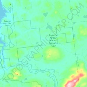
Nombre: Mapa topográfico Jordan River, altitud, relieve.
Lugar: Jordan River, Saint Lawrence County, New York, USA (44.31782 -74.72060 44.38418 -74.51915)
Altitud media: 479 m
Altitud mínima: 413 m
Altitud máxima: 815 m
Otros mapas topográficos
Haga clic en un mapa para ver su topografía, su altitud y su relieve.
Cumminsville
USA > New York > Cumminsville
Cumminsville, North Dansville Town, Livingston County, New York, 14437, USA
Altitud media: 238 m
Sawtooth Mountains
Sawtooth Mountains, Franklin County, New York, USA
Altitud media: 927 m
Big Bear Mountain
Big Bear Mountain, Town of Johnsburg, Warren County, New York, USA
Altitud media: 616 m
Roosevelt Island
USA > New York > New York City
Roosevelt Island, Manhattan Community Board 8, New York County, New York City, New York, 10044, USA
Altitud media: 13 m
Lake Georgina
Lake Georgina, Lake Georgina Road, Woodbury, Town of Woodbury, Orange County, New York, 10930, USA
Altitud media: 290 m
Flat Top Mountain
Flat Top Mountain, Franklin County, New York, USA
Altitud media: 568 m
Lake Cecil
Lake Cecil, Lake Cecil Road, Tacoma, Town of Masonville, Delaware County, New York, 13847, USA
Altitud media: 518 m
Mount Warren
Mount Warren, Town of Bovina, Delaware County, New York, USA
Altitud media: 677 m
Hen and Chicken Islands
Hen and Chicken Islands, Town of Long Lake, Hamilton County, New York, 13436, USA
Altitud media: 606 m
Black Lake
USA > New York > Black Lake
Black Lake, Town of Bethel, Sullivan County, New York, 12720, USA
Altitud media: 391 m