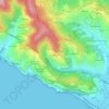
Mapa topográfico Ne
Haga clic en el mapa para ver la altitud.
Ne
Ne stands for Nae, meaning "ship", and refers to the shape of Monte Zatta, the highest mountain of the area at an elevation of 1,404 metres (4,606 ft). It adjoins the valley of Graveglia, the ancient realm of Garibald, the king of the Lombards who fled from Lombardy in 673.
Acerca de este mapa

Nombre: Mapa topográfico Ne, altitud, relieve.
Lugar: Ne, Genoa, Liguria, Italy (44.31377 9.37366 44.40189 9.51776)
Altitud media: 548 m
Altitud mínima: 20 m
Altitud máxima: 1.385 m
Otros mapas topográficos
Haga clic en un mapa para ver su topografía, su altitud y su relieve.