
Mapa topográfico Bulala
Mapa interactivo
Haga clic en el mapa para ver la altitud.
Acerca de este mapa
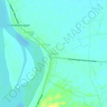
Nombre: Mapa topográfico Bulala, altitud, relieve.
Lugar: Bulala, Cagayan, Cagayan Valley, 3510, Philippines (18.24286 121.66945 18.28286 121.70945)
Altitud media: 4 m
Altitud mínima: -4 m
Altitud máxima: 20 m
Otros mapas topográficos
Haga clic en un mapa para ver su topografía, su altitud y su relieve.
Dalupiri Island
Philippines > Cagayan > Calayan
Dalupiri Island lies about 45 km (28 mi) north of Luzon and about 15 km (9.3 mi) north of Fuga Island. The island has an elongated elliptical shape orientated along a north–south axis, the island has a length of about 18 km (11 mi), with a width of about 7 km (4.3 mi) at its widest point. The topography of…
Altitud media: 25 m
Fuga Island
Fuga has an area of 70 square kilometres (27 sq mi) and a population of 2,015 people. The principal settlement is Naguilian (Musa) village on the southern coast. The highest peak is Mount Nanguringan in the northeast, with an elevation of 191 metres (627 ft).
Altitud media: 9 m