
Mapa topográfico Kechnec
Mapa interactivo
Haga clic en el mapa para ver la altitud.
Kechnec
The village lies at an altitude of 180 metres and covers an area of 10.211 km2. The municipality is part of the administrative units Košice-okolie District and Košice Region. It has a population of about 1080 people.
Acerca de este mapa
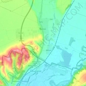
Nombre: Mapa topográfico Kechnec, altitud, relieve.
Altitud media: 188 m
Altitud mínima: 154 m
Altitud máxima: 281 m
Otros mapas topográficos
Haga clic en un mapa para ver su topografía, su altitud y su relieve.